
Geologists may have solved the mystery of the Green River’s ‘uphill’ route
New research may have solved an American mystery which has baffled geologists for a century and a half: how did a river carve a path through a mountain in one of the country’s most iconic landscapes?

Sponsored by

Sponsored by
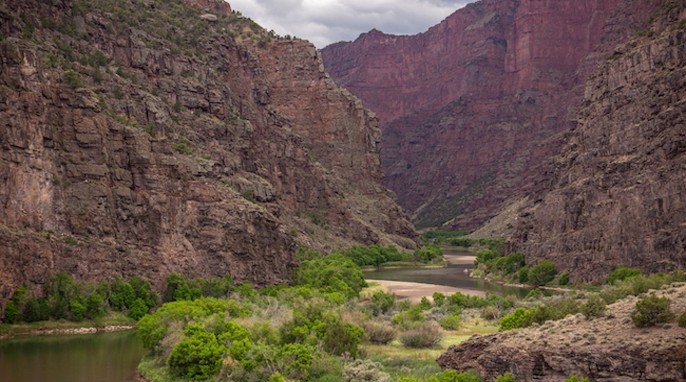
Scientists have long sought an answer to the question of how the Green River, the largest tributary of the Colorado River, managed to create a 700‑metre‑deep canyon through Utah’s 4km-high Uinta Mountains instead of simply flowing around them.
The question is particularly confounding because, while the Uinta Mountains are 50 million years old, the Green River has been following this route for less than eight million years.
Now, researchers from universities in the UK and the USA have gathered persuasive evidence that a phenomenon called ‘lithospheric dripping’, which causes mountains to subside and rebound over millions of years, is likely to be the cause of the Green River’s unusual route.
In order to cut its surprising path through the Uinta Mountains, the Green River ran over land that was temporarily lowered when a lithospheric drip developed beneath the mountains several million years ago. During that time, the river eroded the mountain rock and established the channel it flows through today, including the famous Canyon of Lodore, which eventually linked it to the Colorado River.
Dr Adam Smith, of the University of Glasgow’s School of Geographical & Earth Sciences, is the paper’s lead author. He said: “The merging of the Green and Colorado Rivers millions of years ago altered the continental divide of North America. It created the line that separates the rivers that flow into the Pacific from those that flow into the Atlantic, and created new habitat boundaries for wildlife that influenced their evolution. It’s an enormously significant area of the continent.
“For about 150 years now, geologists have debated over exactly how the rivers merged, which is a particularly challenging question for a tectonically inactive area where major geological events are rarer. We think that we’ve gathered enough evidence to show that lithospheric drip, which is still a relatively new concept in geology, is responsible for pulling the land down enough to enable the rivers to link and merge.”
Lithospheric drips occur when dense, mineral‑rich material forms at the base of the crust, eventually becoming heavy enough to sink into the mantle below. As they sink, they can drag down the land above them, pulling parts of mountain ranges downward.
When the drip breaks off and continues to sink on its own, the mountain range rebounds, leaving behind a distinctive ‘bullseye’‑patterned zone of uplift across the landscape above the drip’s point of origin.
In a new paper published in the Journal of Geophysical Research: Earth Surface, the team show how they used a combination of seismic imaging and sophisticated data modelling to reach their conclusion.
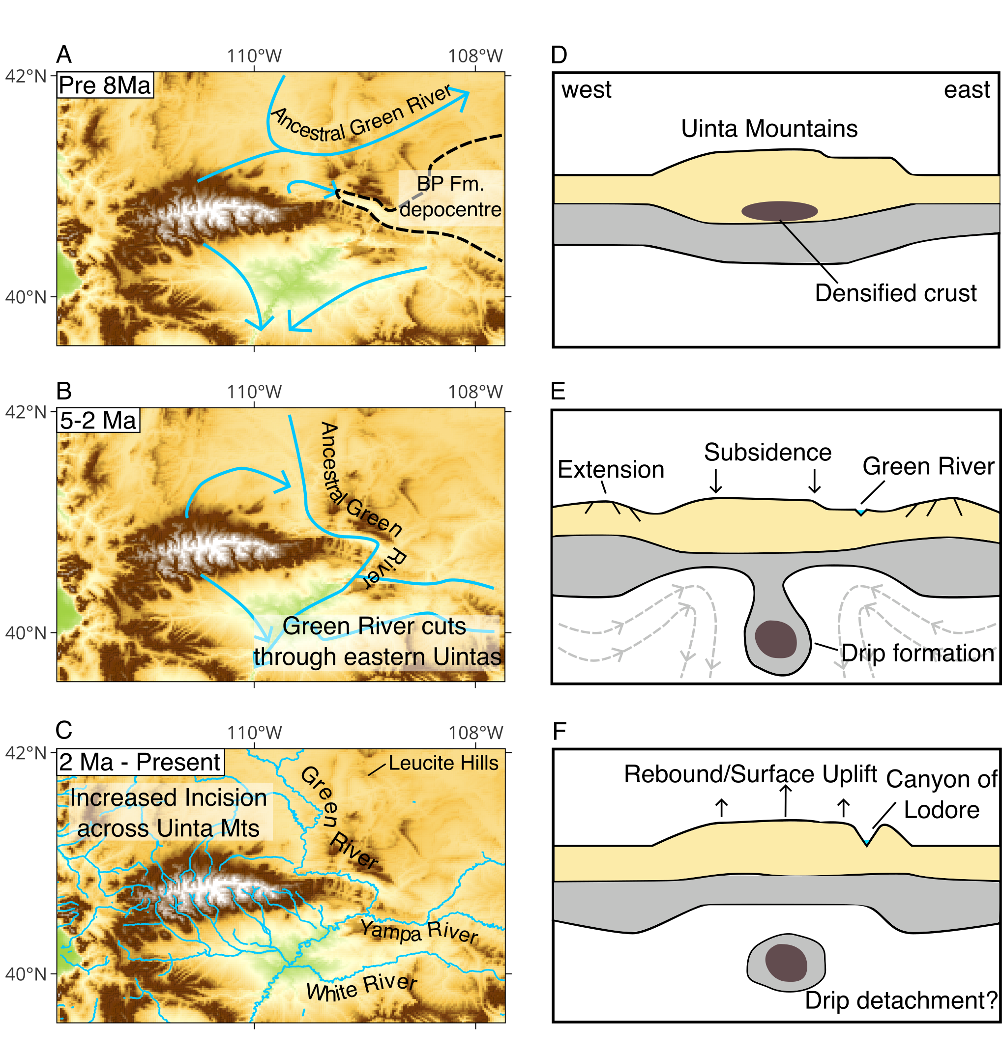
Seismic imaging is a process similar to a CT scan which helps scientists ‘see’ below the planet’s surface by collecting data on how seismic waves move and are reflected during earthquakes. By looking at previously published seismic imaging studies of the mountains, the team identified a cold, round anomaly about 200 km below the surface. This mass, which is between 50 and 100km across, is likely to be the broken-off section of the drip, the researchers say.
By estimating how far the drip had fallen and calculating the speed of its descent, the researchers estimate that the drip broke off between two and five million years ago. Their estimates match well with previous research which estimated the likely period of time during which the Green River cut through the mountains and integrated with the Colorado system.
Using modelling of the river networks, they identified and measured the bullseye pattern of uplift around the mountains – the telltale ‘fingerprint’ of a lithospheric drip. They also found that the crust beneath the Uinta Mountains is several kilometres thinner than expected for a mountain range of its height, which the team say is consistent with dense lower‑crustal material having dripped away. When they calculated the surface uplift expected from this missing material, it matched the roughly 400‑plus‑metre elevation change they had inferred from the river networks.
Dr Smith added: “This is a long paper, because we wanted not just to lay out the case for a lithospheric drip creating the route of the Green River but also to acknowledge some previous theories. The evidence we’ve collected strongly contradicts the idea that the river predated the mountains, or that sediment deposits might have built up enough for the river to overtop the range, or that erosion from the south of the mountains captured the Green River.
“We hope that this paper will help resolve a longstanding debate about one of North America’s most significant river systems, and help build the growing body of evidence that lithospheric drips may be the hidden answer to more tectonic mysteries than we’ve previously realised.”
Researchers from University College London, the University of Utah, and the Utah Geological Survey contributed to the research and co‑authored the paper. The team’s paper, titled ‘A lithospheric drip triggered Green and Colorado River integration’, is published in the Journal of Geophysical Research: Earth Surface.